
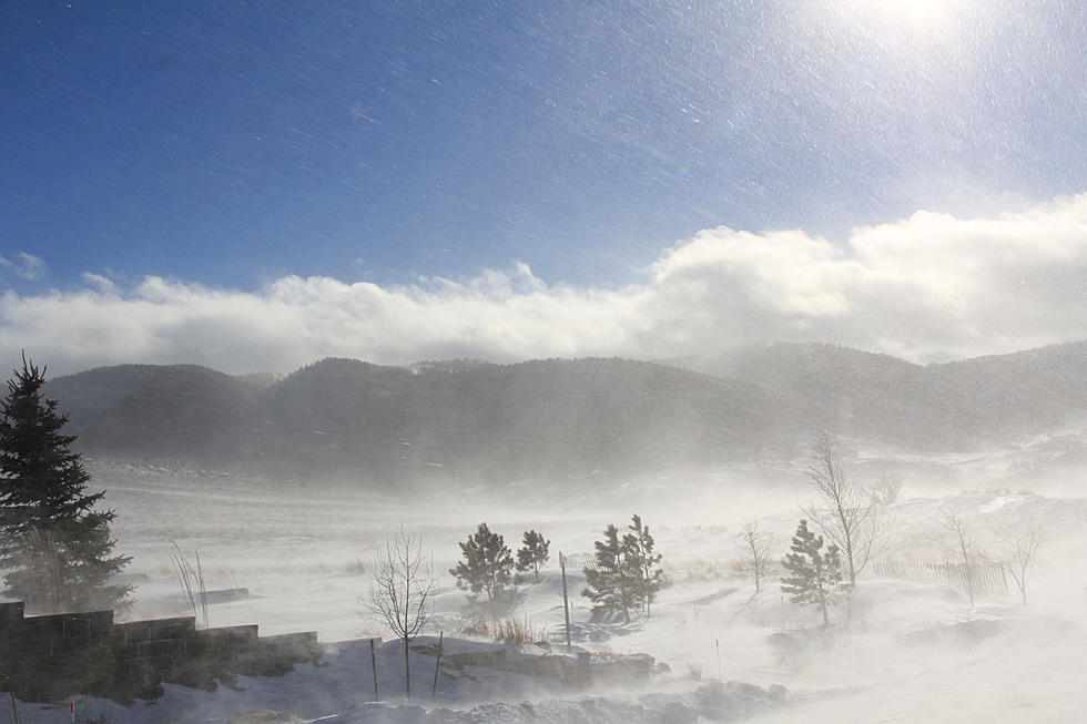
NWS: Major Winter Storm Could Bring 4-8 Inches of Snow to Casper
The National Weather Service has updated its prediction for a major winter storm that could move through Wyoming early next week, warning of the potential for significant snow accumulation and exceptionally difficult travel conditions.
Casper and Kaycee, as well as southeast Johnson County and lower elevations in Natrona County, could see four to eight inches of snow accumulation from Sunday evening through late Monday night -- the effective period of a winter storm watch issued Friday afternoon.
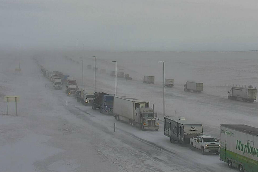
Tim Troutman with the National Weather Service said Friday afternoon that travel through parts of the Cowboy State Sunday evening into Monday evening and possibly early Tuesday will be "difficult to dangerous."
Troutman also said there is a strong possibility blowing snow will impact travel on Interstate 80 in southern Wyoming.
Casper Mountain could see six to 12 inches of snow pile up.
The weather service says expected snow amounts will likely change as the storm approaches and details become clearer. Troutman said meteorologists will have a clearer picture of what to expect Saturday evening.
It is expected to be the heaviest snowfall since Thanksgiving for areas east of the Continental Divide.

More From AM 1400 The Cowboy


![Casper: Who Do You Want To Win The Super Bowl This Year? [POLL]](http://townsquare.media/site/147/files/2020/01/GettyImages-1201925623.jpg?w=980&q=75)

![[VIDEO] Here’s The Gun Cabinet Suited For All Wyomingites](http://townsquare.media/site/103/files/2019/09/Guns.jpg?w=980&q=75)

![I-25 Reopens Between Casper and Douglas [UPDATED]](http://townsquare.media/site/101/files/2020/01/I25NaturalBridgeEast-980.jpg?w=980&q=75)
![Winter Weather Closes I-80 Between Cheyenne and Laramie [UPDATED]](http://townsquare.media/site/105/files/2020/01/I80TavernWest-980.jpg?w=980&q=75)